Roads across Virginia keep changing. New intersections, wider lanes and fresh utility work show up in growing areas every year. Before any of that dirt gets moved, someone has to know exactly where the design sits on the real ground. That’s part of what a construction surveyor does.
VDOT builds surveying into its roadway projects. Its roadway-development process includes survey work while a project is being planned, and it keeps separate guidance for survey work during construction. Public road jobs and private sites don’t follow the same rules. Both still share one need. The plan has to line up with the actual site before earthwork starts.
The same idea applies to commercial and private grading. Before heavy equipment reshapes the ground, a construction surveyor can set up the control and field information the crew needs. That work turns the drawings into real marks on the site, so the team builds from the design instead of a guess.
The Ground Has to Match the Plan Before Earthwork Starts
Grading can’t run on a good eye alone. A design lives on paper as numbers, lines and target heights. The real site is bumpy, sloped and rarely a perfect match for the drawing. A crew that only eyeballs it may start cutting or filling in the wrong spot.
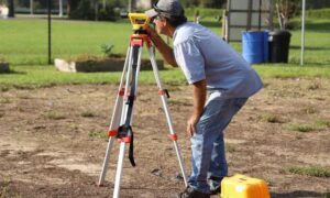
A construction surveyor connects the two. The plans say where the finished ground should sit. The field shows what’s there right now. The surveyor places real reference marks so the drawing points to actual locations on the dirt.
This step happens before the big machines arrive. The surveyor sets a small number of trusted marks the crew can build from. Once those are in place, everyone works from the same starting information.
Small gaps between the plan and the ground are easier to handle early. A benchmark that doesn’t line up, a corner that sits a few feet off, a height that reads wrong, all of these are cheaper to sort out before dirt moves. Catching them after a machine has already cut a slope costs far more time.
Control Points Give the Grading Crew a Reliable Starting Reference
Survey control is the fixed set of known points a project measures from. Think of it as the anchor for every later measurement. If the anchor is solid, the work built off it stays consistent.
Control comes in two kinds. Horizontal control fixes location, meaning where a point sits left to right and front to back. Vertical control fixes height, meaning how high or low a point sits compared to a known level. A construction surveyor sets these points, or checks points that already exist, and ties them to a known reference.
One shared set of marks matters for a simple reason. Crews often grade a large site in pieces, and different crews may work different corners. When they all measure from the same control, the parts fit together. When each crew picks its own reference, the work can drift apart.
Virginia’s road work leans on this same idea. VDOT’s survey guidance covers GNSS, which is satellite positioning like GPS, along with control and construction surveying. Reliable control sits under that kind of transportation work for a reason. It keeps the field tied to the plan as the job moves forward.
Grading Changes More Than the Shape of the Site
Moving dirt does more than flatten a lot. It changes how the new work meets everything around it. A raised pad, a cut driveway or a new parking area all have to connect back to the ground that stays put.
Those connection points deserve attention early. The site has to tie into existing ground at its edges. Driveways and entrances have to meet the road at a workable height. If the finished grade sits too high or too low next to what’s already there, the fix later can be messy.
Survey information helps the team see these height relationships before a single load of soil moves. The surveyor can show how the planned grades relate to the road, the neighbors and the untouched parts of the site. That view lets the team spot an awkward transition on paper first.
This matters more in areas with active road work, and Virginia has plenty of it. Roadway projects can carry their own survey, terrain data, right-of-way limits, drainage information and utility details as part of the larger project. A private site next to that kind of work still follows its own plan and rules. The two aren’t the same. A site that ties into a changing road benefits from clear elevation information at the boundary.
Early Survey Checks Can Catch Problems Before Equipment Moves Soil
A quick check before grading can surface questions while they’re still easy to answer. The surveyor compares what the plans show against what the field holds. When those two don’t match, it’s better to know now.
A few things tend to turn up. Reference points may be unclear, missing or shifted from where the plan expects them. Elevations may read one way in the field and another way on the drawing. Site features on the ground may not match what the plan shows.
None of this means a survey removes every risk. Grading can still hit surprises once digging starts, and no check catches everything. What an early review can do is flag the open questions while the ground is still untouched.
That timing is the real value. A question raised before earthwork often clears up with a phone call or a plan review. The same question found mid-cut can stop a crew and leave equipment sitting. Sorting it out first keeps the small problems small.
When Projects Benefit From a Construction Surveyor Before Grading
Some projects lean on this pre-grading work more than others. A construction surveyor before grading tends to earn its place on jobs like these:
- Commercial site development
- New building or facility construction
- Large amounts of earthwork
- Sites next to existing roads or road improvements
- Sites where new grades have to meet existing features
- Projects built in more than one phase
- Jobs that need survey control set before any field work starts
The common thread is simple. When the design has to meet the real ground with any precision, early control and field references help the crew hit it. The more moving parts a site has, the more that early setup pays off.
The right survey work still depends on the project itself. Its plans, size, site conditions and the rules that apply all shape what’s needed. For transportation-related work in Virginia, VDOT keeps its own survey and construction guidance, so project teams should confirm the requirements that apply to their specific job. A licensed surveyor familiar with the area can point a project toward the right scope before grading begins.