New homes and shops bring more cars, and the roads have to keep up. In many places, developers help pay for that through impact fees or by building road upgrades themselves. Either way, the work has to match approved plans closely, or it may not be accepted.
That’s where construction staking comes in. Survey crews mark the lines, grades, and points that tell contractors exactly where to build. Good staking keeps the road inside the right-of-way, keeps utilities in the right place, and leaves a clear record when the agency reviews the job.
Construction Staking Requirements for Impact-Fee-Funded Road Improvements
An impact fee is a charge a locality may place on new development to help pay for public needs like roads. Some developers pay the fee in cash. Others build specific road improvements, and in some places they may get credit toward the fee for that work.
When a developer builds the road, the finished work usually has to meet the standards of the agency that will own it. That might be a city, a county, or a state transportation agency. Those standards often cover lane widths, curb types, pavement depth, and drainage, and they can shape how layout and checks are done.
Before staking starts, gather the approved plans, the agency’s specs, and any permit conditions. Ask whether the agency wants certain checkpoints, such as inspections before paving. Requirements vary by locality and project, so confirm them early.
Layout starts from survey control, which is a set of fixed points with known positions. Every stake on the job is set from those points. If the control is off, the whole road can be off with it.
Roadway Widening Limits Along Existing Property Frontages
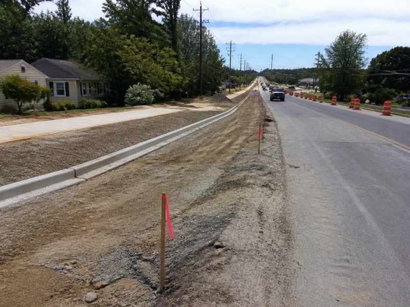
Many impact-fee projects widen an existing road. That often means adding a turn lane, a shoulder, or a sidewalk in front of homes and businesses. The new edge has to stay inside the public right-of-way or inside land the project has legally gained through a purchase or easement.
Survey crews stake the right-of-way line, the new edge of pavement, and the limits of grading. These stakes show the contractor how far the work can go. They also help neighbors see where work will happen before the machines show up.
Watch for features near the line, such as mailboxes, driveways, fences, signs, and trees. Some may need to be moved, and some may belong to the property owner. Staking makes those conflicts easy to spot early.
Driveway tie-ins need special care. When the road gets wider or higher, each driveway has to be reshaped to meet it. The crew sets grades so cars can still get in and out without scraping.
Intersection Geometry and Curb Return Layouts
Intersections are where small errors cause big problems. A curb return is the curved section of curb at a corner. Its radius controls how easily trucks and buses can turn.
Crews stake the start and end of each curve, the radius points, and offset lines for the curb crew. They also stake crosswalks, curb ramps, and islands. Grades matter here too, since water has to drain away from ramps and crossings.
Curb ramps must meet accessibility rules, which limit slopes and call for features like detectable warning surfaces. The design sets those details, and the layout has to match them closely. A ramp that ends up too steep may have to be torn out and rebuilt.
Ask for a check of the curb forms before concrete is placed. Corners are hard to fix once they’re poured. A quick field check costs far less than removal.
Utility Relocation Points Within Proposed Road Corridors
Road widening often runs into utilities. Poles, water lines, gas mains, and fiber cables may sit where the new lanes or sidewalk will go. Those lines usually have to be moved before road work can finish.
Surveyors stake the new spots for poles, valves, manholes, and other features. Utility companies and their contractors use those stakes to plan their work. Clear marks help keep relocations from landing in the wrong place.
Timing is a big deal. Utility moves can take months, and they often have to happen before paving. Share the staking schedule with each utility early so their crews and yours aren’t waiting on each other.
Always call the utility locate service before digging. Stakes show where new work should go, but they don’t mark every buried line already in the ground. Use both together for a safer job.
Construction Staking Records for Project Verification and Acceptance
Before an agency accepts a new road, it usually wants proof that the work matches the plans. Records from layout and field checks help provide that proof. They show where stakes were set, what grades were used, and what changed in the field.
Many projects also need an as-built survey at the end. This survey measures what was actually built, such as curb lines, pavement edges, and drainage structures. Agencies may compare it with the approved plans before they accept the road or release a bond.
Keep notes on any field changes and who approved them. A change made without a record can slow acceptance or lead to a dispute later. Good records also help if impact-fee credits depend on showing the work was completed.
Frequently Asked Questions
What is staking on a road project?
Staking is the process of marking road lines, grades, and key points in the field. Survey crews use stakes, paint, and nails to show contractors where to build. Marks are set from survey control so they match the plans. This keeps the road in the right place and at the right height.
Who pays for survey layout on an impact-fee road?
It depends on how the project is set up. When a developer builds the road, the developer usually hires the survey team through its contractor or engineer. Some agreements spell out who handles layout and checks. Review your agreement and ask the locality if anything is unclear.
Can staking records help with impact-fee credits?
Staking records and as-built surveys can help show that work was finished as planned. Whether credits apply depends on local rules and your agreement. Some localities have specific steps for claiming credits. Talk with the locality and your attorney about what proof they need.
Do neighbors have to allow work on their property?
Work generally has to stay inside the right-of-way or areas the project has rights to use. If work is needed beyond that, the project may need an easement or written permission. Stakes help show where those limits are. Legal questions should go to an attorney.
How early should survey layout start?
Bring the survey team in before construction starts. Control has to be set and checked first. Utility relocation stakes may also be needed early. Starting late can hold up crews and push back the schedule.